Madera County GSA Measurement Services
The Request for Proposal (RFP) issued by the Madera County Groundwater Sustainability Agencies (GSAs) seeks proposals from qualified consultants to provide satellite measurement services for 2026. The contract(s) may be awarded for a one-year or multi-year term. RFP Measurement Methods Posting
Notice of Measurement Method Request for Proposals (May 15, 2025)
Issued RFP on May 15, 2025: May 2025 Grower Eblast Newsletter
Questions received by May 30,2025 regarding the RFP, along with Madera County GSAs’ responses, are now available: RFP Questions and Responses May 2025
Vendor Proposals (June 16, 2025)
- Hydrosat (Measurement data)
- Land IQ (Measurement data)
- California Water Data Consortium (Measurement data + platform)
- 4 Creeks with Basinsafe (platform)
- Davids Engineering and H2oTech with RemoteTracker (platform)
- MLJ with Watermark (platform)
- United Water Tracking Systems with the Water Dashboard Accounting Platform (platform)
Vendor Presentations (July 1, 2025)
- Hydrosat
- Land IQ
- California Water Data Consortium
- 4 Creeks with Basinsafe
- Davids Engineering and H20Tech with RemoteTracker
- MLJ with Watermark
- United Water Tracking Systems with the Water Dashboard Accounting Platform
Questions for RFP Responders (July 18, 2025)
RFP Questions for Respondents 2025
Responses to Grower Questions (July 21, 2025)
Respones to Grower Questions from DE_H2oTech
Response to Grower Questions from LandIQ
Responses to Grower Question from CA Water Data Consortium
Responses to Grower Question from MLJ_Watermark
Responses to Grower Question from United Water Tracking System
Responses to Grower Questions from 4 Creeks
Responses to Grower Questions from Hydrosat
Accounting Webinar (October 3, 2025)
Webinar Recording 10/03/2025 Password: y.$l?X6%
Accounting Platform Demos
Davids Engineering H2oTech
BasinSafe Username: Demoaccount | Password: Demo123!
California Water Data Consortium
Measurement
What is being measured?
Within the County Groundwater Sustainability Agency (County GSA), water use on irrigated acres is measured.
How is water being measured?
The County GSA measures water used by irrigated agriculture within the County GSA. In 2023, the County GSA offers three methods for growers to choose from for measurement:
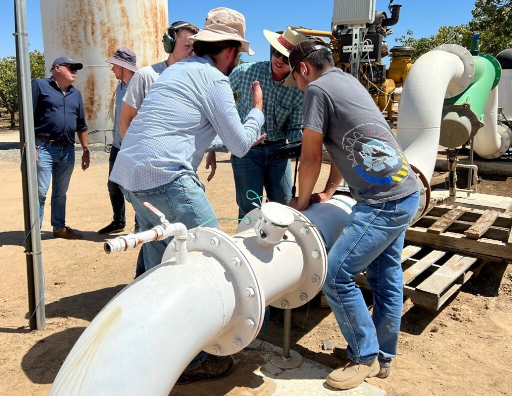
Three field staff wearing hats inspecting a large water flow meter installed on outdoor piping
1. IrriWatch
- Madera County GSA Growers Public Workshop 2/12/2026
- IrriWatch Webinar Use Passcode: vaf.23ab
- Irriwatch Portal Guide
2. Private meters (with pre-inspection both for installation and for flow calibration and a map of meter and well locations and what each well irrigates, along with monthly meter reads uploaded to our portal; see list at bottom of the page with potential vendors for inspections)
- Madera County GSA Flow Meter Approval Checklist
- Madera County GSA Meter Attestation Form
- Madera County GSA In Field Flow Meter Calibration Form | Additional Meter Page
- Madera County GSA Approved Vendors For Flow Meter Inspection Services List
- Madera County GSA Meter Inspection Request for Qualification Process
- FAQ How to Submit Monthly Meter Data
You must select the same measurement method for all APNs within your Master Account.
Additional Resources
Evapotranspiration of Applied Water Appeal Process
2022 Verification Project Results Grower Workshop 2/28/2023
2023 Preliminary Growers Workshop Presentation 1/22/2024
Madera Verification Final Project Report 2023
2024 Preliminary Project Results Grower Workshop 1/27/2025