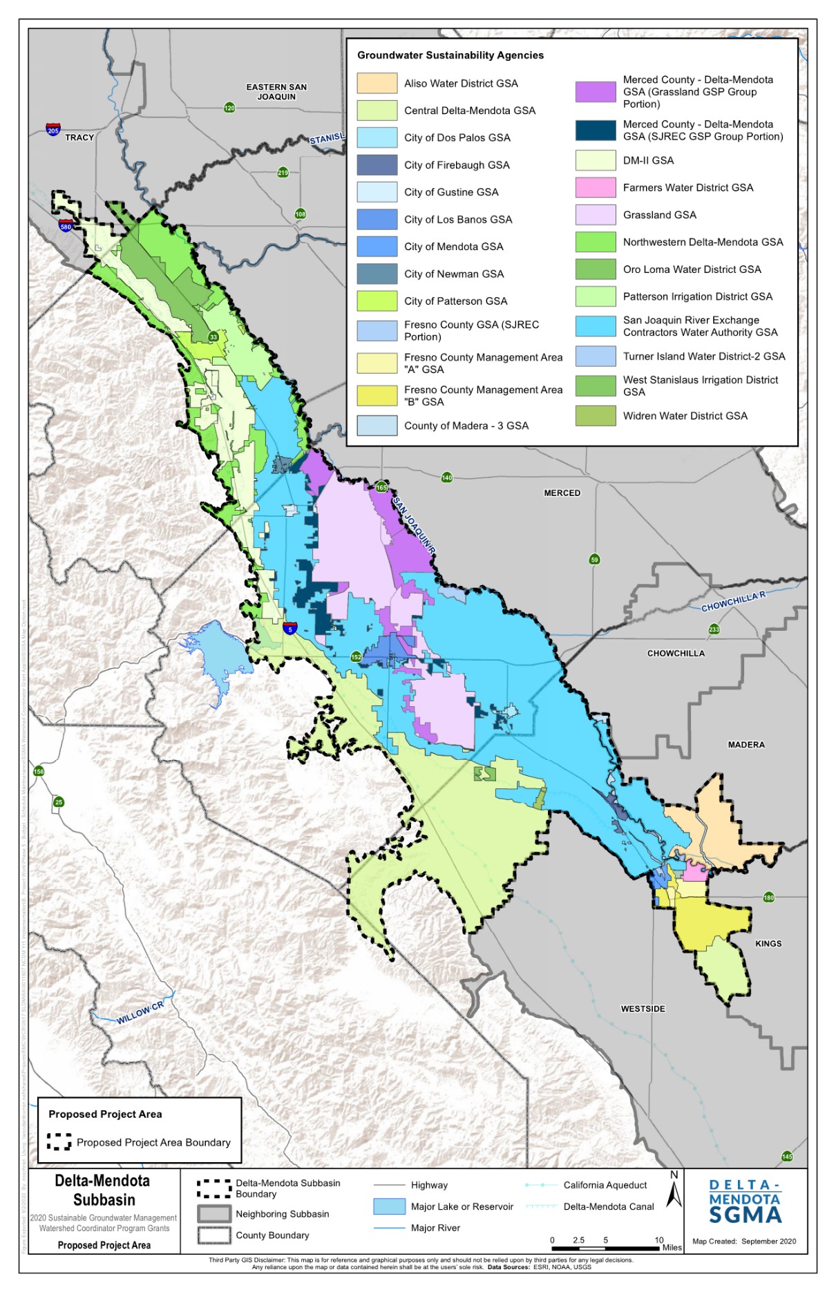
The Delta-Mendota Subbasin exists within the larger San Joaquin Valley Groundwater basin, as described in the California Department of Water Resources Bulletin 118. The County of Madera is the exclusive GSA for the portion of the Delta-Mendota Subbasin in the unincorporated area of Madera County, and not otherwise covered by another public agency. If you’re not sure what GSA you are in for the Madera Subbasin, use this interactive map.
2024 Delta-Mendota GSP
Final GSP – Delta-Mendota SGMA (deltamendota.org)
Delta-Mendota Subbasin Single GSP – Memorandum of Agreement
Full Special Project Agreement for Single GSP Development
2022 June Revised SJREC GSP in the Delta-Mendota Subbasin
FINAL SJREC GSP-2022
Appendix A – FINAL SJREC GSP
Appendix B – FINAL SJREC GSP-2022
Appendix C – FINAL SJREC GSP-2022
Appendix D to G – FINAL SJREC GSP-2022
Appendix H – FINAL SJREC GSP-2022
Appendix Ia – FINAL SJREC GSP-2022
Appendix Ib – FINAL SJREC GSP-2022
Appendix J to M -FINAL SJREC GSP-2022
Appendix N to Q – FINAL SJREC GSP-2022
Appendix R & S – FINAL SJREC GSP-2022
Appendix T to W – FINAL SJREC GSP-2022
Resolution 2022-097
San Joaquin River Exchange Contractors GSP Group in the Delta-Mendota Subbasin
SJREC GSP Final December 2019
SJREC Appendices Part One
SJREC Appendices Part Two
SJREC Appendices A-H
SJREC Appendices J-R
SJREC Appendices S-W
Delta-Mendota GSP Annual Reports
Delta Mendota Annual Report WY2025
DRAFT Consolidated WY2023 Annual Report March 2024
Consolidated WY2022 Annual Report March 2023; Appendix A; Appendix B
Draft Consolidated WY2020 Annual Report March 2021
Contour Maps for Water Year 2020 Annual Report:
- Seasonal High Lower Aquifer (Spring 2020)
- Seasonal High Upper Aquifer (Spring 2020)
- Seasonal Low Lower Aquifer (Fall 2019)
- Seasonal Low Upper Aquifer (Fall 2019)
Resources
GSP Upload Checklist
GSP Upload Process Final
Visit the Delta-Mendota SGMA website for more information!